Log in
All resources
Create a design
4,886 Free Images of Map Lichen
bibliothèque nationale de france
john rocque
john rocque's 1748 map of london and adjacent country
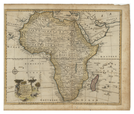
1596 maps of africa
propaganda map
1529 maps
1529 maps of iran
cornelis anthonisz.
old maps of asia
reconstruction of ruysch's africa map by stanley
proveniershof, haarlem
1689 map of haarlem
1529 maps of iran
1529 maps
1529 maps of iran
1529 maps
carriages in the 1680s
prints of haarlem
maps of the ottoman empire by mercator-hondius
eran laor cartographic collection
1529 maps of iran
1529 maps
curt teich postcard archives
map postcards
maps of the ottoman empire by mercator-hondius
eran laor cartographic collection
1529 maps of iran
1529 maps
reconstruction of ruysch's africa map by stanley
dans les ténèbres de l'afrique (1890)
reconstruction of ruysch's africa map by stanley
new light on dark africa (dulcken)
reconstruction of ruysch's africa map by stanley
im dunkelsten afrika (1890) by wobeser
john and sebastian cabot. a study (1886)
map of juan de la cosa
reconstruction of ruysch's africa map by stanley
stanley in afrika's donkere wildernissen (1890)
reconstruction of ruysch's africa map by stanley
im dunkelsten afrika (1890) by wobeser
early netherlandish painting
t and o map
nature
tree
arnold van langren map of east africa
1600 maps of africa
john rocque's 1748 map of london and adjacent country
bibliothèque nationale de france
john rocque's 1748 map of london and adjacent country
bibliothèque nationale de france
john rocque's 1748 map of london and adjacent country
bibliothèque nationale de france
map of amsterdam by gerrit de broen (ii)
bibliothèque nationale de france
map collection of leibniz-institut für länderkunde
19th-century maps of the bosphorus
map of amsterdam by gerrit de broen (ii)
bibliothèque nationale de france
john rocque's 1748 map of london and adjacent country
bibliothèque nationale de france
map of amsterdam by gerrit de broen (ii)
bibliothèque nationale de france
john rocque's 1748 map of london and adjacent country
bibliothèque nationale de france
arnold van langren map of southwest africa
1596 maps of africa
john rocque's 1748 map of london and adjacent country
bibliothèque nationale de france
john rocque's 1748 map of london and adjacent country
bibliothèque nationale de france
john rocque's 1748 map of london and adjacent country
bibliothèque nationale de france
map of vienna by jacob hoefnagel
roter turm, vienna
map of amsterdam by gerrit de broen (ii)
bibliothèque nationale de france
map of vienna by jacob hoefnagel
roter turm, vienna
descriptio daciarum (17th-century map)
maps by pieter van der keere
maps by girolamo porro
1596 maps of africa
dexter press postcards of arizona
curt teich postcard archives
maps by girolamo porro
1596 maps of africa
postcards with 2 images
map postcards
maps by girolamo porro
1596 maps of africa
amsterdam in the 1540s
agnietenkapel
1652 maps
shipmills
bologna ptolemy
1477 maps
1747 persia map by emanuel bowen
details of old maps
turgot map of paris, kyoto university library – derivative files
petit luxembourg on old maps
old maps of the london underground
maps by macdonald gill
turgot map of paris, kyoto university library – derivative files
couvent des capucines
map of brugse vrije by pieter claeissens de jonge
drawings in the groeningemuseum
san giovanni battista (venice giudecca)
demolished churches in de barbari map
coats of arms of the tsardom of russia
details of sigismund's map of moscow
1747 persia map by emanuel bowen
maps in the library of congress
map collection of leibniz-institut für länderkunde
maps of portugal by fernando álvares seco
blue coat school, dublin
1906 books
america
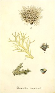
coral
america
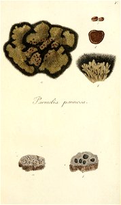
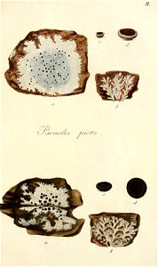
lichen
america
lichen
hendrik van langren map of south asia
1596 maps of asia
collections of the amsterdam museum
hasan çolpan
postcards of st. louis, missouri
curt teich postcard archives
john rocque's 1746 map of london
old and new london (book)
hendrik van langren map of south asia
renaissance
hendrik van langren map of south asia
1596 maps of asia
prints by cornelis anthonisz. in the rijksmuseum amsterdam
map of amsterdam, 1544
postcards of ottawa county, oklahoma
curt teich postcard archives
details of old maps of amsterdam
jan roodenpoortstoren
1830s maps of the world
maps by daniel lizars
map of the circle of austria by sanson
context files from gallica
map of the circle of westfalia by sanson
1680s maps of germany
maps by girolamo porro
1596 maps of africa
map of the circle of franconia by sanson
1680s maps of bavaria
1529 maps of africa
1529 maps of iran
1529 maps of iran
1529 maps
maps of amsterdam in the rijksmuseum amsterdam
map of amsterdam, 1544
carta hydrographica y chorographica de las yslas filipinas
baroque painting
turgot map of paris, kyoto university library – derivative files
enclos saint-lazare
maps by petrus schenk
1750s maps of saxony
cornelius aurelius world map
ptolemaic taprobana
map of rome by giovanni battista falda (1676)
maps in the rijksmuseum amsterdam
map of maastricht by willem and johannes blaeu (1649)
jezuïetenwal (maastricht)
historical map collection
maps by emanuel bowen
john rocque's 1746 map of london
details of old maps of london
edward wright (mathematician)
maps by jodocus hondius
leicester square
leicester house
18th-century maps of ireland
old maps of dublin
john rocque's 1746 map of london
details of old maps of london
map of ghent by folkema, harrewijn, 1785
collections of ghent university library
stedenboeken van de wereld by johannes janssonius 1657
map of ghent by jan blaeu
map of ghent by lucas de heere
collections of archief gent
1520s maps of the world
propaganda map
john rocque 1746 london map (a1-h3)
st george's fields, southwark
koninklijk oudheidkundig genootschap, amsterdam
map of amsterdam, 1544
eran laor cartographic collection
afbeeldinge der stad jerusalem
map of bruges by marcus gheeraerts (i)
drawings in the groeningemuseum
1747 persia map by emanuel bowen
1740s maps of georgia
map of paris by braun & hogenberg - derivative files
pont aux meuniers
maps of paris from bibliothèque nationale de france
dheulland map of paris
arnold van langren map of southwest africa
renaissance
map of paris by braun & hogenberg - derivative files
le marais
historical images of place du carrousel
rue saint-nicaise (paris)
maps of paris from bibliothèque nationale de france
dheulland map of paris
2401 - 2500 of 4,886
Next page
/ 49


![Map 12 [Tabula 12], 1477](https://cdn.creazilla.com/illustrations/10000439389/map-12-tabula-12-1477-md.jpg)